STRIMMAN - THE STRIPE
by Ville Kronlid
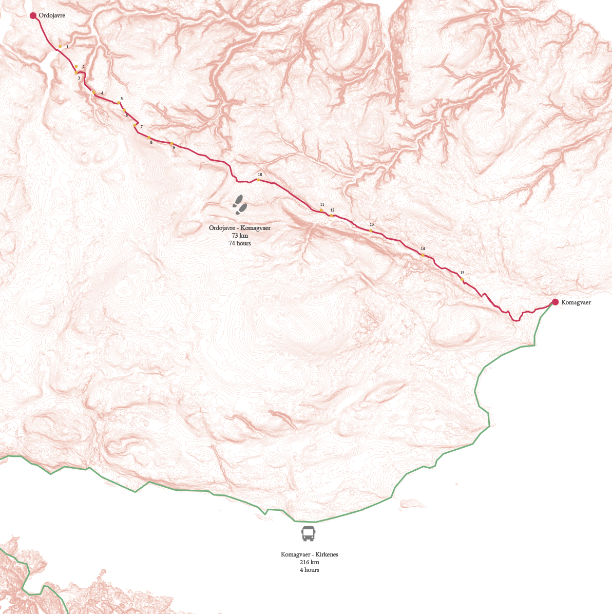
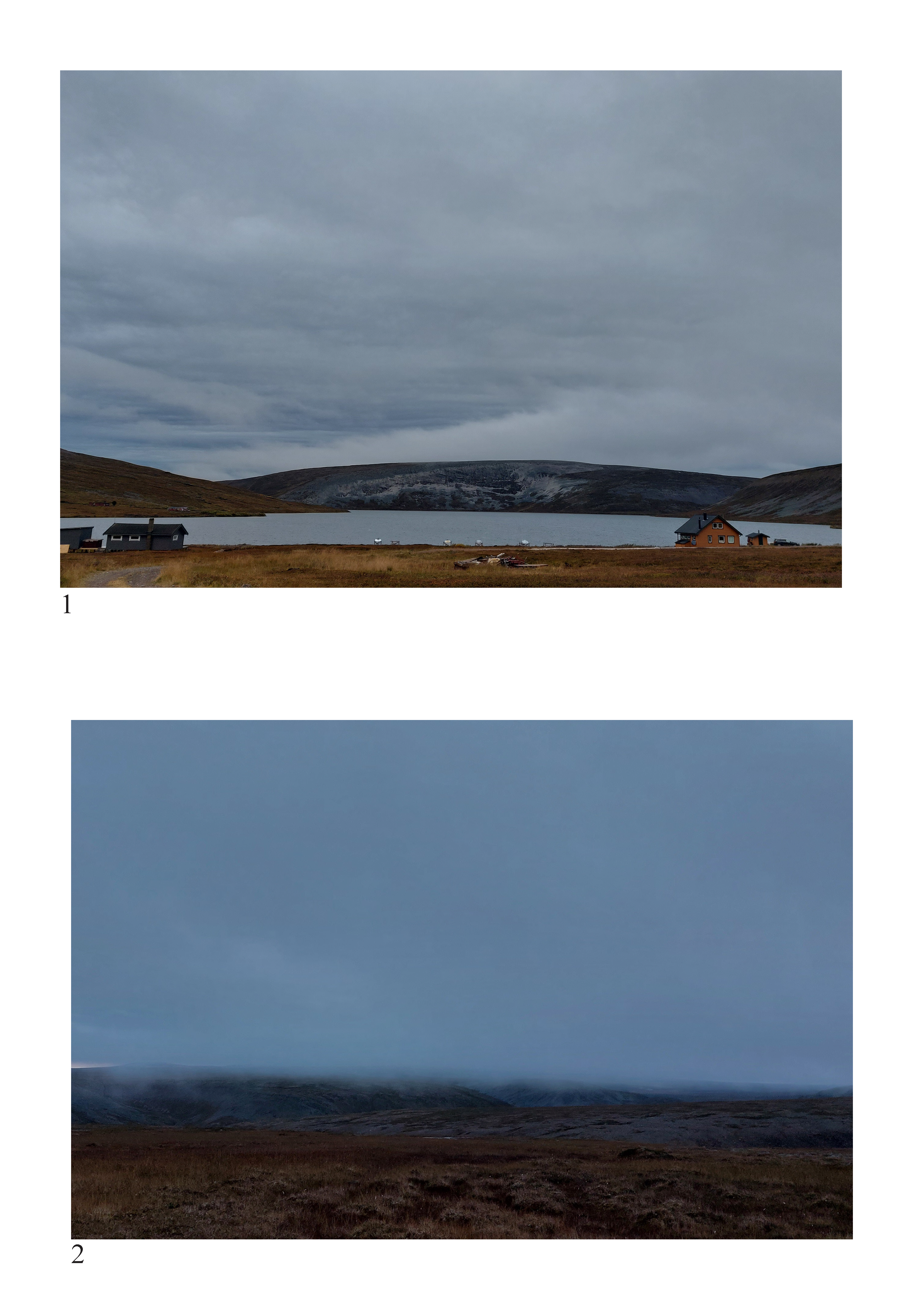
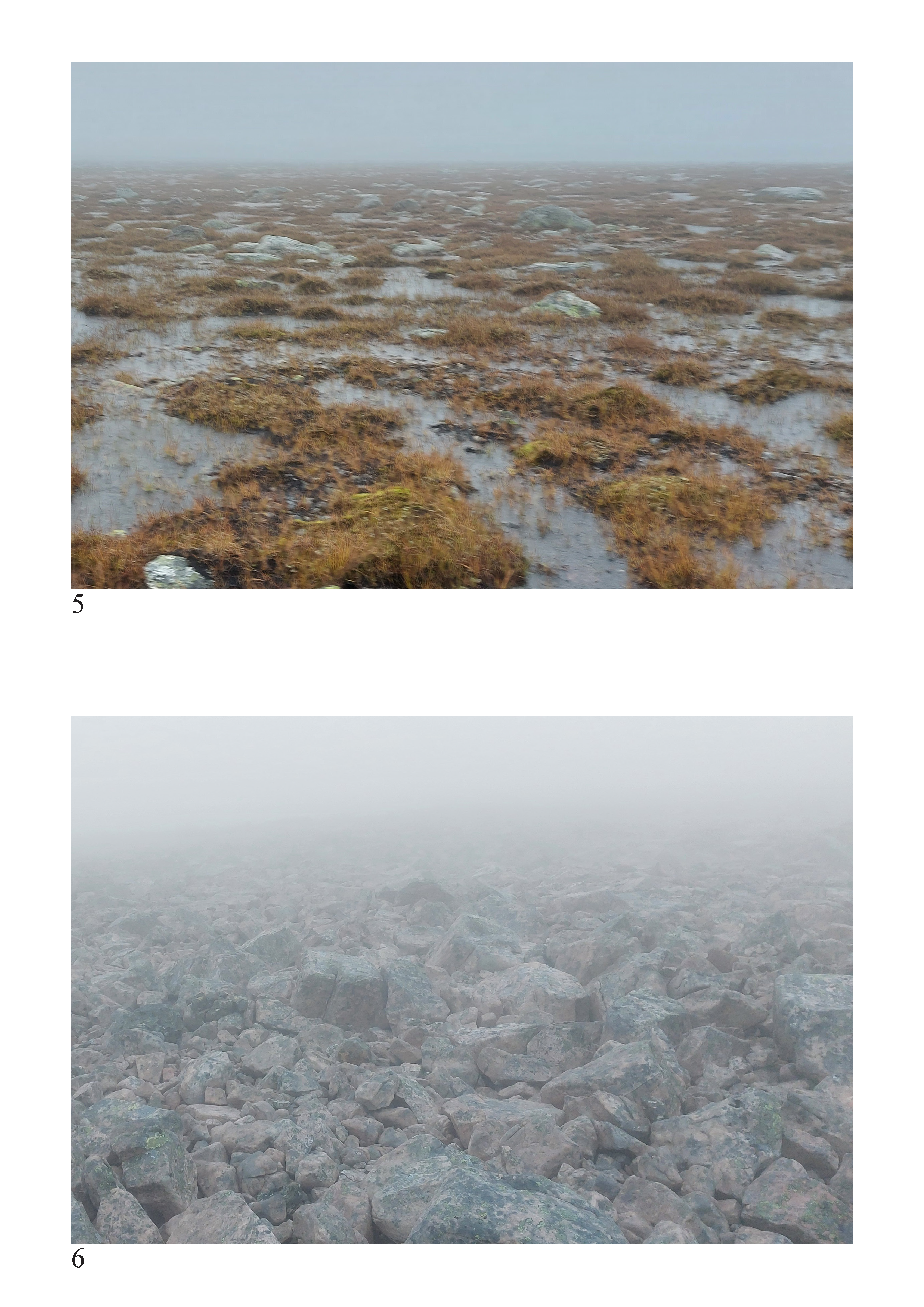
In the days after the field trip to the Varanger area, I hiked for 74 hours across the national park. Partially because I like hiking. But also because I wanted to get to know the area, an interesting way of doing so is by walking.
When walking, there is a sequence of moments between point A and point B. Moments that are full of sensory input, moments when you feel the wind, the rain, the texture of the ground under your feet. When you physically feel the incline of hills. All of this is true and relevant to larger landscapes, but even more relevant in cities. This creates a long corridor of moments and experiences connecting point A and point B
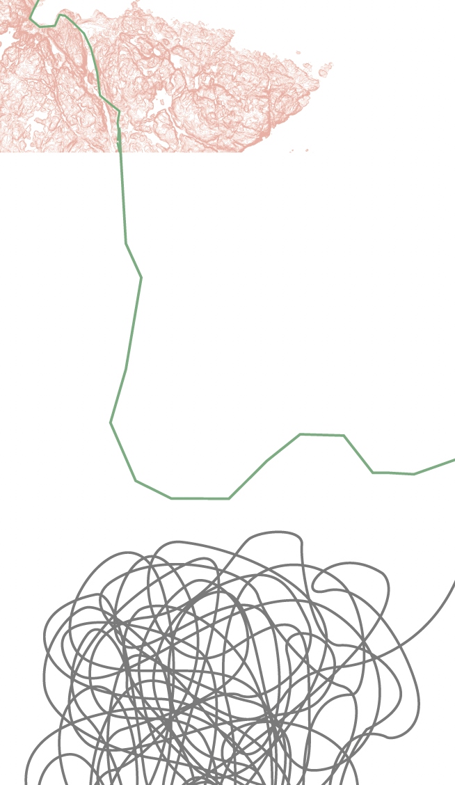
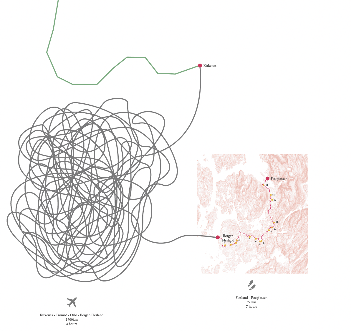
After the hike, I took a bus to Kirkenes and then a flight back to Bergen. Here, I have tried to illustrate the difference in proportion between distance and time through these different modes of transport. Showing how much closer you get to an environment when walking through it.
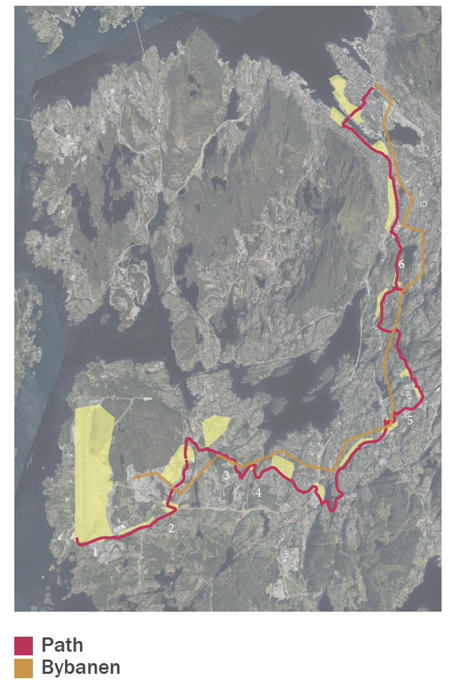
Two months after the field trip, I walked from Flesland airport to Festplassen to complete the sequence and, in some way, mirror the walk in the national park. To apply the method of walking to get to know a region to the city I live in.
It was especially exciting to walk to the airport because, in doing this, you typically pass through the whole city with all its layers.
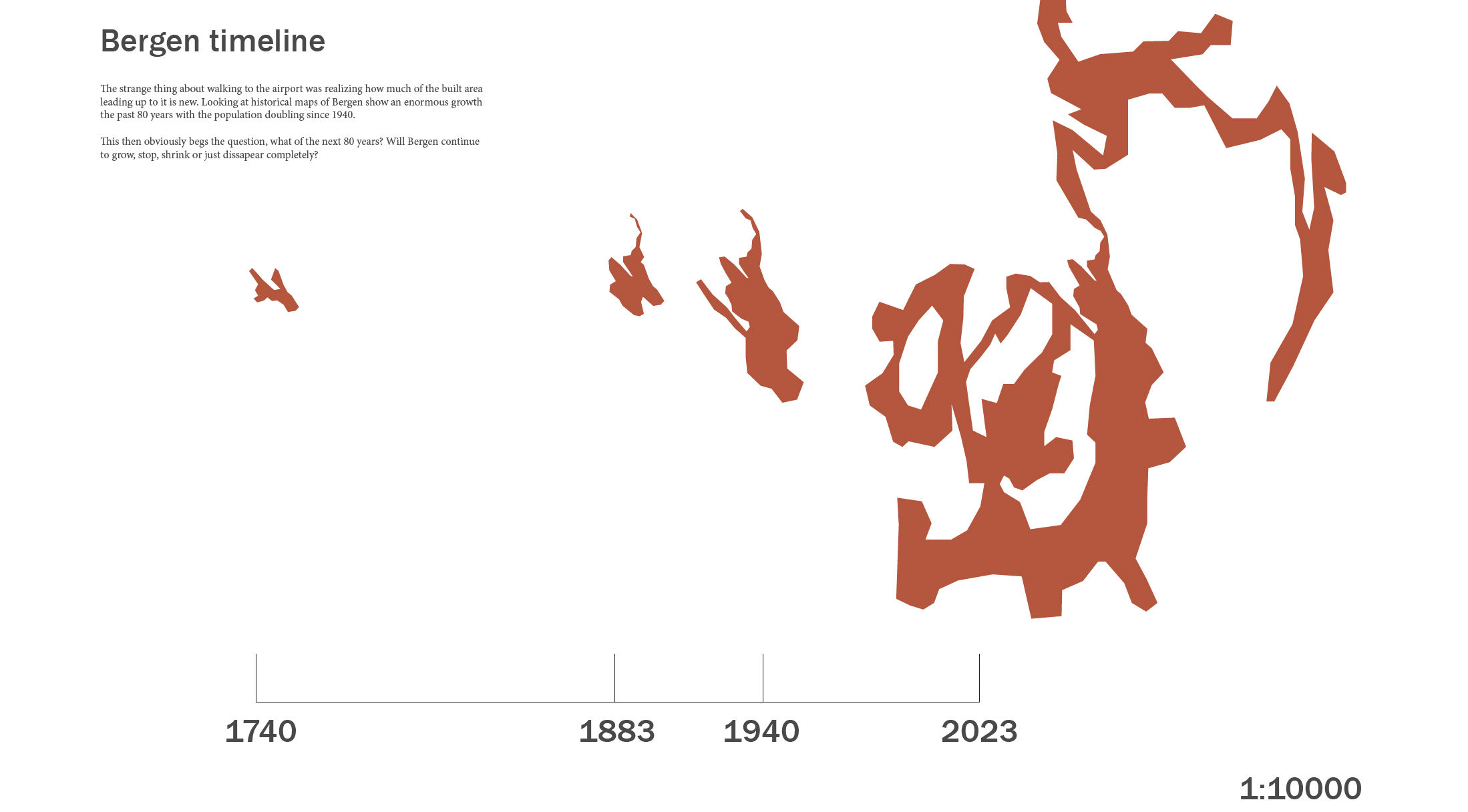
There was a strong shift from the central parts of the city to the larger periphery. In the centre, the buildings and spaces have arranged themselves over hundreds of years and probably will continue to do so.
In the periphery, there was a road, asphalt, large office and wholesale buildings, together with housing. The periphery was not strung together; it was built to quickly solve problems. There was no street life, few parks, and not much for pedestrians.
The question I want to answer concerns the aspect of time. What happens to these very specific buildings and systems in the future, and how can a city adapt to that? How can walking support these fragmented spaces? The answer to part of this is a path through the city.
Maybe it is not only the industry that will fall out of use. Will there be airplanes in fifty years? Then the airport will be absorbed. Will the harbour be in use, or will that turn into an urban park? Will all the residential areas be filled or will they slowly be abandoned, turning the villa gardens into microparks?
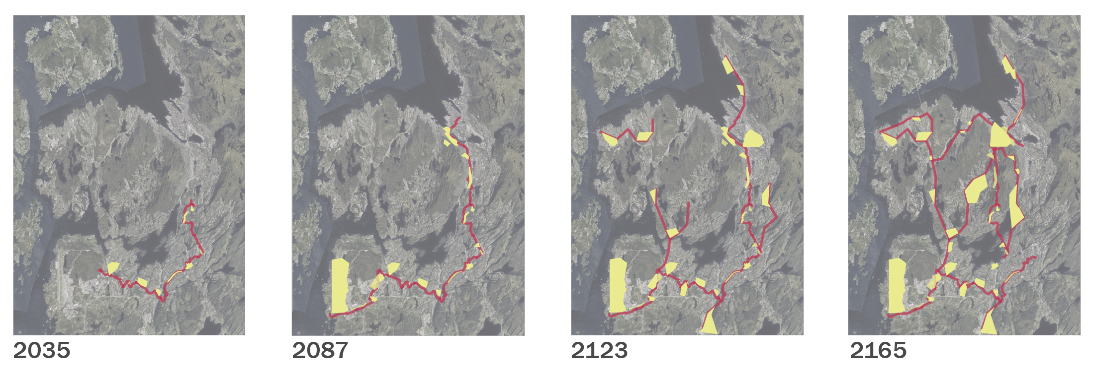
Here are four maps with scenarios of the proposed path and park growth. The path grows as the in-between spaces are appropriated and changed, slowly, year by year, while the walking in itself will drive that process forward.
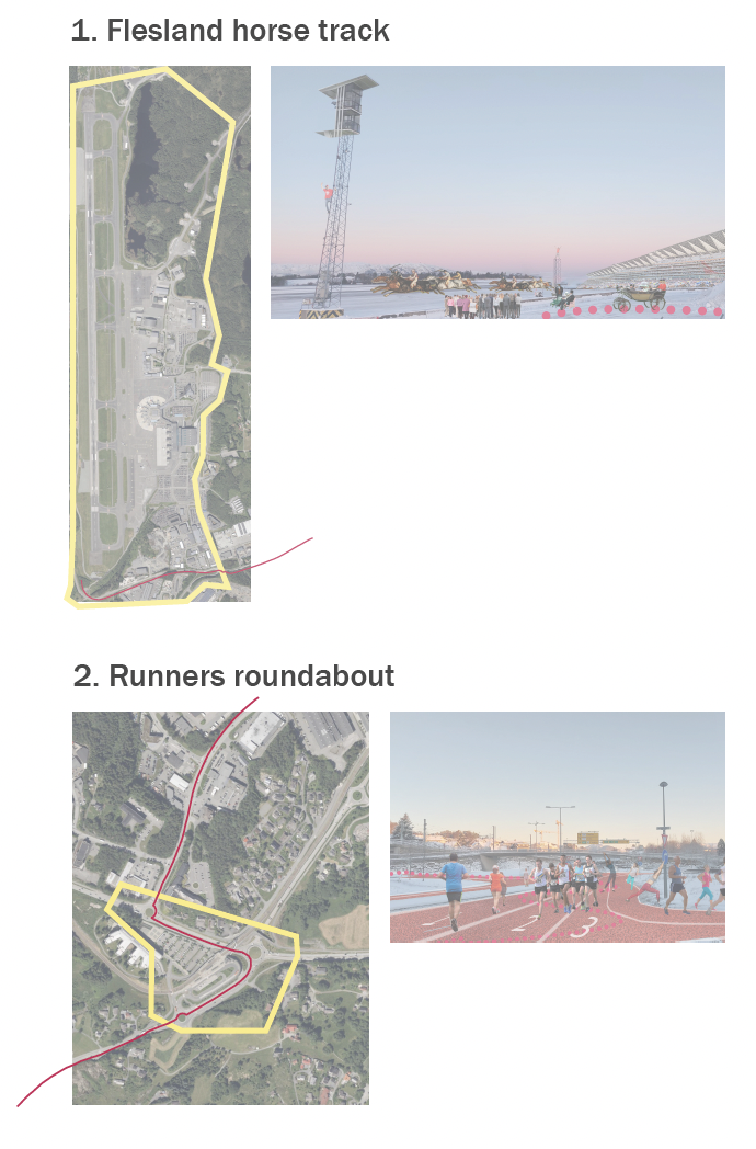
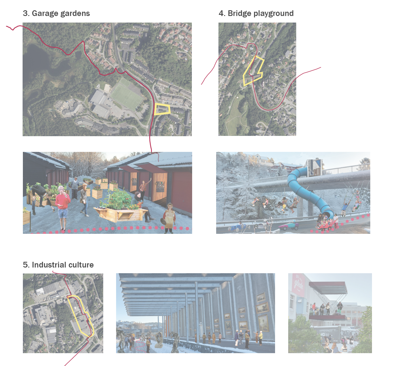
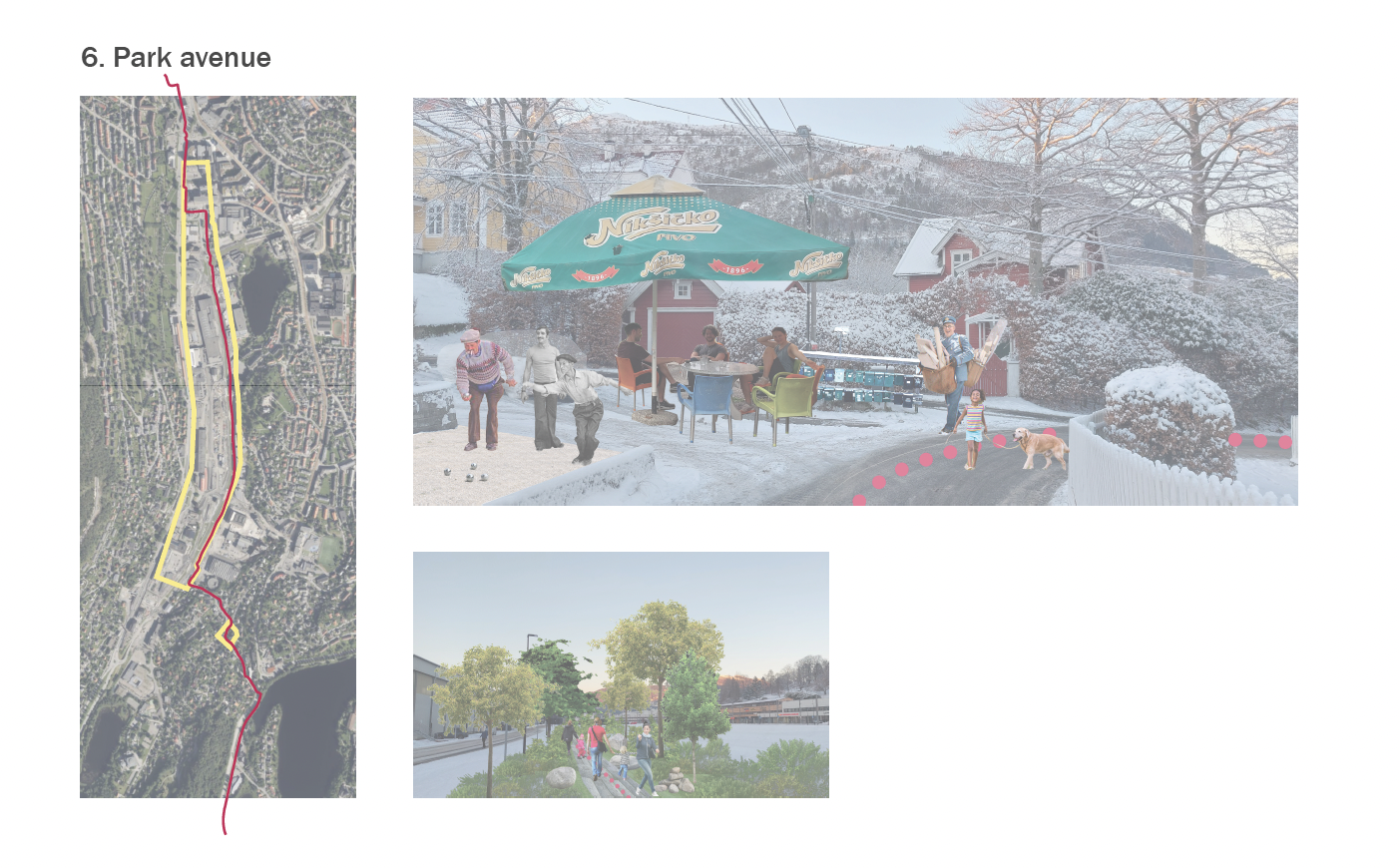
 When I walked to Flesland, there was an appalling lack of commons. Few benches, parks, and playgrounds. On the other hand, there was a lot of space left over.
 The in-betweens can be of different scales. In local little hangouts or larger spaces, people will walk the length of the whole promenade.